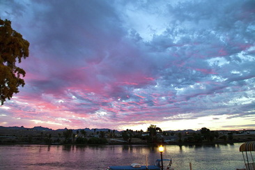
 Sunrise over the Colorado River We got up early to photograph the sunrise. Before it got too hot, we walked over to the outlet mall and did some window shopping. The forecast high for today is 105 F. We tried our hand at Keno and won $67.00: we are going to quit while we're ahead. Tomorrow we are bound for Flagstaff.  Evening sky from Laughlin 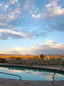 Sunset from the Golden Nugget pool
 Sunrise Desert Hot Springs, CA We were up and en route early this morning in hopes of beating the heat. In return for our effort we did have a couple of hours of relatively cool driving and we watched a colourful sunrise over the desert.
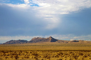
We drove across the Mojave Desert today, and it was HOT. It was also very lonely. I kept checking for call boxes. They were five miles apart and I calculated that including the melted ice in our cooler and the club soda, we had enough water that we might be able to walk that far and live. It was a big relief when we passed a cell phone tower.
For a few miles, we also drove on Route 66. We got our kicks and saw our first roadrunner of the trip.
We are staying at the Golden Nugget, in Laughlin. As a new member of the casino Gold Card Club, I received a credit for $10 in the casino., which we quickly deposited in the slots.
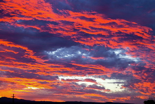
The casinos are located along the Colorado River. There is a pedestrian walkway along the river. Once it cooled down to about 90 F, we went for an evening walk. The river supports a variety of wildlife: we saw ducks, fish, bats and skunks.
Trip mileage: 3010 miles
 Between Palm Springs and Laughlin
The forecast temperature for Rancho Mirage today was 102 F. We left San Diego early this morning in order to beat the heat. We took the Temecula-Indio road which climbed up through the San Bernardino mountains (4 000 ft.) then descended through a landscape of rock, sand and cactus to the valley bottom. We could see the heat waves rising from the valley as we approached. We are staying in motels for the next few days because it is too hot to camp. Hopefully, by the time we reach Flagstaff, it will cool down enough for us to get back to camping.
Trip mileage: 2777 miles
 Bob Hope Park We drove from Ventura to San Diego on Saturday. We had anticipated that the drive would be stressful: it lived up to our expectations. We are proud to say that we navigated the interstates through Los Angeles and we are still married.
The first part of the drive wasn't bad. We drove along the coastline from Ventura to Santa Monica on the California 1 Coast Road. It follows right along the shoreline and on Saturday it was well used by joggers and cyclists. There were hundreds of people on road bikes. We were impressed by the continuous stretch of sandy beaches. As it was the weekend families were out enjoying the day at the beach. Surfers were catching waves all along the drive.
From Malibu right through to San Diego it got hectic. In places there were 10 lanes in each direction. Bob got us into the carpool lane and that is pretty much where we stayed. It was very hot out and as we don't have air conditioning we had all the windows down. The noise of traffic, wind and tires on the road was deafening.
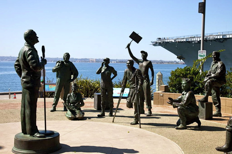
We are camping at a KOA in Metro San Diego.. It is a lovely oasis of trees and grass and we have enjoyed the pool. The temperatures have been in the 90's F. Apparently it is unusually hot for this time of year. There is easy access to the San Diego transit system from our campground so today we rode the bus/trolley in to the Embarcadero area of San Diego Harbour and did a three hour "walking tour" of the USS Midway.
The Midway is an aircraft carrier. It was commissioned in 1945, just after WWII ended. At that time it was the largest carrier in the world and the first too large for the Panama Canal. It was decommissioned in 1992 after serving as the Navy flag ship in Desert Storm, and now serves as a naval aviation museum. We walked almost 6 miles on the boat. They let us go almost anywhere. We toured the bridge, flight deck, hangar decks, accommodation decks, Captain's cabin, Admiral's cabin. The ship was a floating city with a crew of 4 500. There was a big difference in the size and quality of accommodations between the officers and the enlisted men. The enlisted men's quarters would not be a goo place for anyone with claustrophobia.
San Diego Bay is beautiful and active. We watched sailboats, kayaks, pleasure craft, barges and navy ships go past. There were two huge cruise ships docked at the Embarcadero. We were surprised to see that the San Diego airport is adjacent to the bay. Landing aircraft approach from directly over downtown.
The US Pacific fleet is headquartered in San Diego. The naval base and ship yard is huge. The trolley went past the ship yard and we saw a number of different vessels including a couple of hospital ships.
Trip mileage: 2649 miles
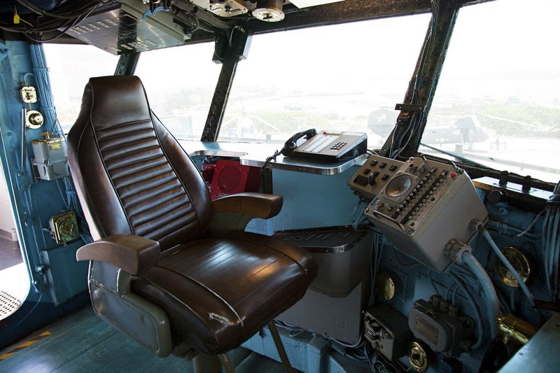
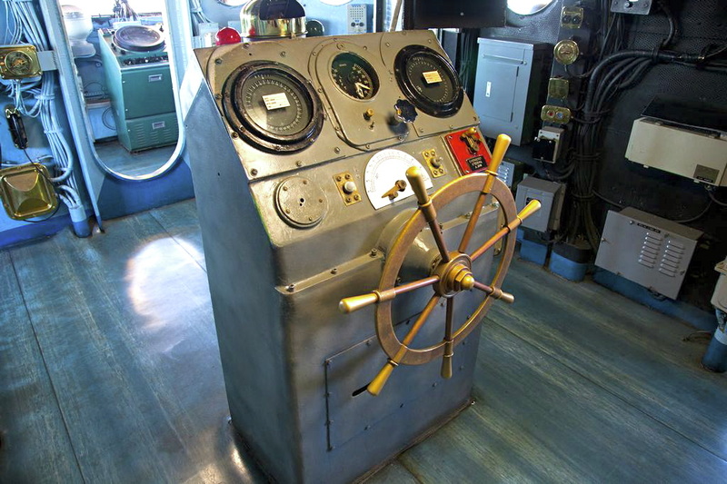
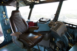 Captain's chair, USS Midway  Ship's wheel, USS Midway 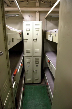 Sailor's quarters, USS Midway
 Farmer's Market, San Luis Obispo The sun has set, the crickets are singing, the stars are beginning to twinkle out and the harvest moon is rising in the eastern sky. We are sitting out on our "patio" in the mountains just 15 miles west of Ventura, near the town of Santa Paula. The temperature rose to the high 80's F today, and now
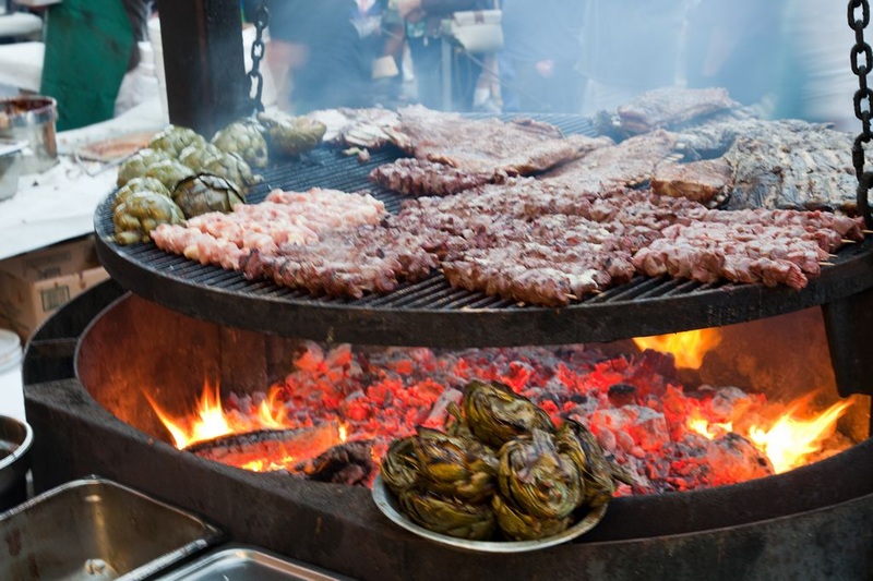
 BBQ with artichokes, San Luis Obispo Our route today along California 101 followed the historic El Camino Real (the Royal Road). In the 1700s this road was a footpath linking the twenty one missions between San Diego and San Francisco. At that time bells were posted along the route to provide travellers with directions and distances to the missions. Today, there are commemorative bells along the highway.
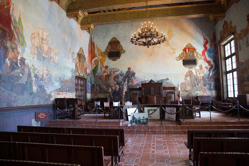
The area from San Louis Obispo and Santa Barbara is wine country. We passed by vineyards growing grapes of every kind. There was lots of other agricultural activity going on as well. 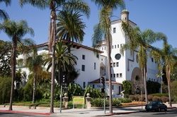 Santa Barbara County Courthouse We stopped for a couple of hours in Santa Barbara. Most of our time was spent touring the Santa Barbara County Courthouse which is an architectural wonder. In 1925 most of the city of Santa Barbara was ruined by an earthquake. The County Courthouse was built in 1929 to inspire the community to rebuild in the Mediterranean style that is so prevalent today. The courthouse features brilliantly coloured tiles in the Spanish-Moorish style, towers, arches, grand murals that depict the history of the area and open air galleries. It is a working courthouse.  Supervisor's Assembly Room, Santa Barbara Courthouse From Santa Barbara to Ventura the road followed along the coastline. We were amazed by the vast sandy beaches and surprised to see offshore oil rigs. I counted about twelve oil rigs in the thirty miles stretch between the two cities. At Ventura we took another couple of hours to stroll along the beach, watch the surfers and dip our feet in the ocean. Then we continued on to our camp spot. As we moved away from the coast we drove past orchards of lemon trees and flower farms. It seems just about anything will grow here.
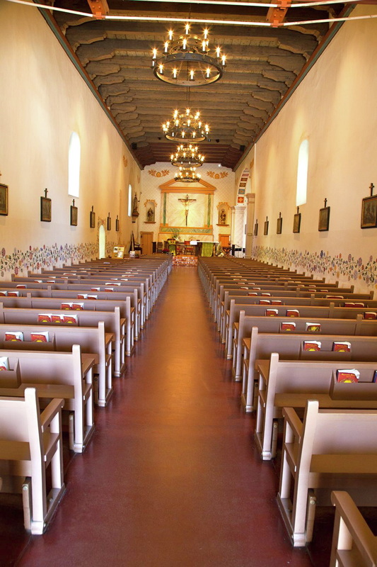
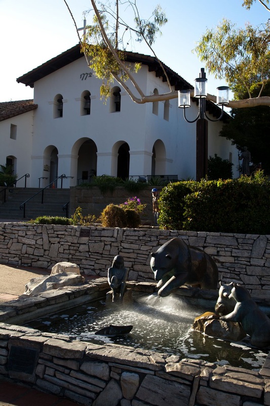
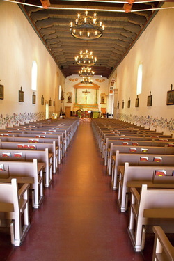 San Luis Obispo mission We could certainly get used to California living. Our stay in San Luis Obispo has been thoroughly enjoyable. Today the temperature was in the low 80's F. We spent the morning exploring the downtown area and touring the mission.
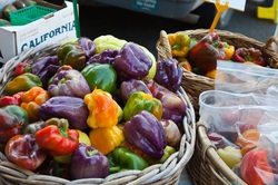
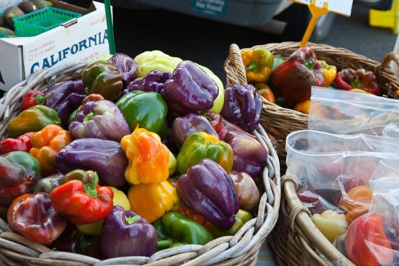
Every Thursday evening is Farmers' Market here in SLO. One of the streets in the core of downtown is blocked off for several blocks. It is a popular community event . We were amazed at the produce that was displayed. There were fruits and vegetables of every type as well as nuts (walnuts and almonds), dates and figs and fresh flowers. It is difficult for those of us from the frozen north to comprehend that locally grown fresh produce could be sold in a street market every week throughout the year. In addition to the produce, local restaurants had booths set up to create a street BBQ. Live musicians added to the festive atmosphere. We basically ate our way from one end of the market to the other.
This morning we woke to the sound of seals barking. We didn’t plan to spend much time in Morro Bay, but we did walk to the marina. Morro Bay is a wildlife refuge, well sheltered from the open ocean. This morning the water was like glass. There were thousands of birds swimming, flying, diving and wading. We also saw seals. Judging from the activity the bay must provide a good source of food.
We drove only a short distance today, inland to San Luis Obispo, home of Cal Poly Tech. The city grew up around a mission that was founded in 1772. The population is young and the atmosphere is relaxed.
Trip mileage: 2254
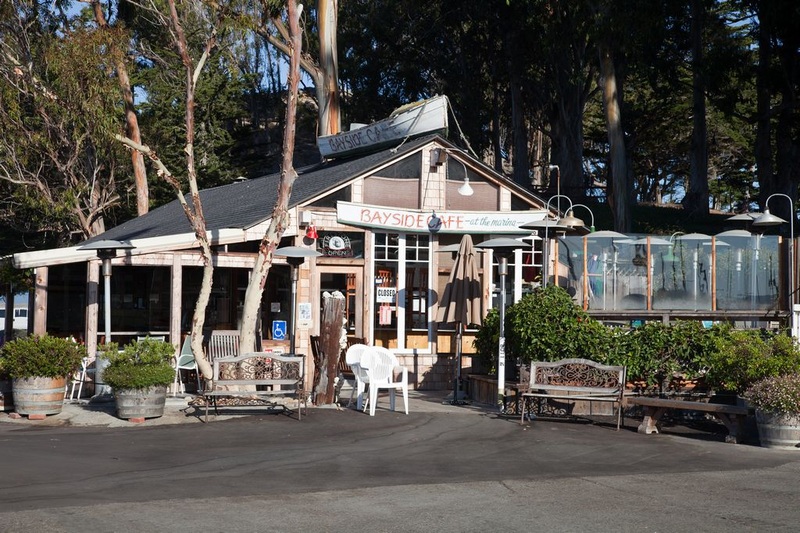
 Bayside Cafe, Morro Bay  San Luis Obispo mission 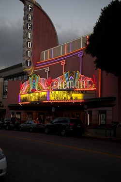 Fremont Theatre, San Luis Obispo
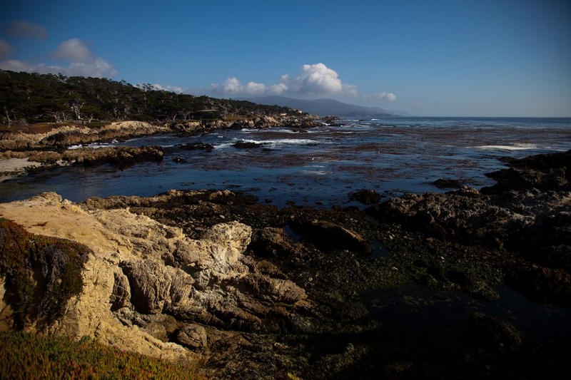
 Along 17 Mile Drive, Monterey
This was our longest day yet. We covered about 250 miles along California 1, which follows the coastline.
Our day started at the Golden Gate Bridge. The traffic was slow, but that gave us a chance to soak in the experience. The road from San Francisco to Santa Cruz ran through rich farmland. We passed mile upon mile of vegetable crops. In the various fields it looked as though they were planting, weeding and harvesting different crops simultaneously. We saw orange pumpkins piled on wagons and in the fields. The other major crop seemed to be artichokes.
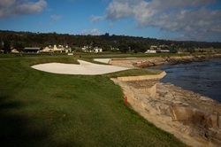
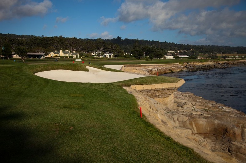
Bob wanted to take this opportunity to visit Pebble Beach. There is a 17 mile scenic route around the Monterey Peninsula which visitors can access for a fee of $9.50. It was well worth it. The road wound through forest, along the rugged coastline, by some grand homes and past the very famous golf courses: The Links at Spanish Bay; Spyglass Hill and Pebble Beach. We walked out to the 18th hole at Pebble Beach and looked out on the panoramic view of the golf course and ocean from the Lodge.
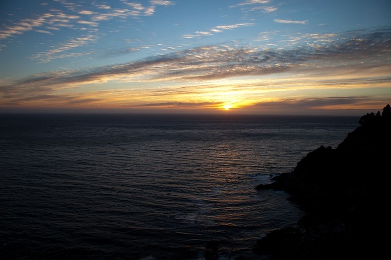
Beyond Monterey the Santa Lucia mountain range meets the Pacific at the shoreline. The road hugs the shoreline. It is very rugged and the views are spectacular. We made slow progress. It would not be an exaggeration to say that we stopped every 1/4 mile to soak in yet another breathtaking view. It was almost a relief when the sun finally set and we weren’t able to be distracted by the scenery. Bob needed to stay focussed on the road. The going in the dark was slow as the road twisted along the precipitous shoreline.
Just before Morro Bay the mountains pulled away from the shore and the road flattened out. By the light of the almost full moon we could catch glimpses of glinting waves and the white foam where the waves were breaking on the beaches.
We were pretty tired by the time we pulled into our campsite. We set up by moonlight and fell asleep to the sound of an owl hooting from high up in a tree beside the van.
Trip Mileage: 2214 miles
 18th Hole, Pebble Beach  Sunset at Big Sur
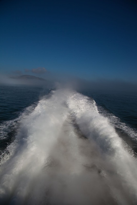
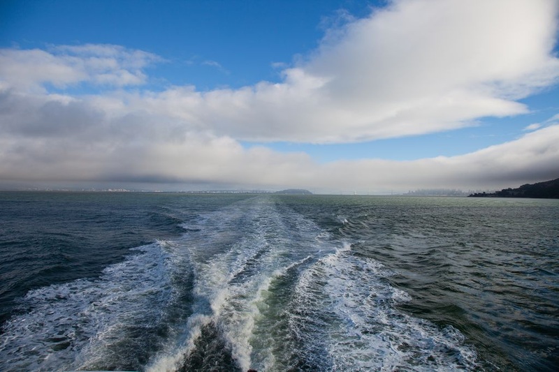
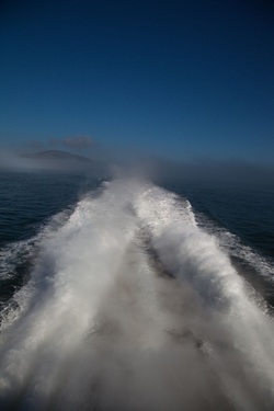 Larkspur Ferry wake
Our second day in San Francisco was full of interesting sights and new experiences. We spent twelve non-stop hours visiting the areas that were of interest to us. After our walking tour yesterday, we decided to make use of the MUNI transit system in order to cover the distances and give ourselves a break from climbing hills. We travelled by bus, streetcar and the N Train. We did end up walking a fair distance as well. However the climate here is so gentle and pleasant, we wanted to be outside as much as possible.
Our first destination was Union Square, then we hopped on a bus and headed out to Japantown. After the hustle and bustle of Union Square, Japantown felt peaceful and relaxing. It is one of only three remaining Japantowns in the United States. We had planned to be there in time for lunch and after scouting the many restaurant options finally made our choice. We were not disappointed.
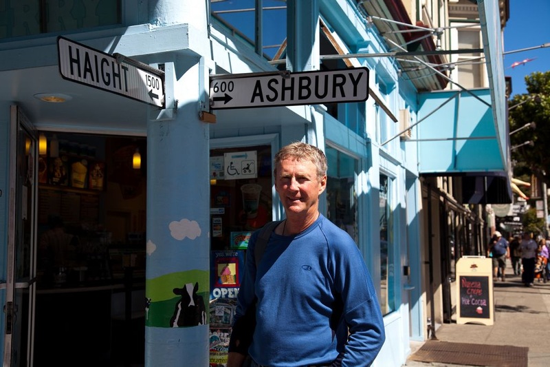
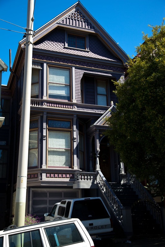
Bob was very interested in visiting the Haight-Ashbury district, so that was our next stop. It was not as “gritty” as we had anticipated. Although there is an eclectic Bohemian feel to the area, it is very much geared for the tourists. We took pictures on the corner of Haight and Ashbury and then went and stood in front of #710 Ashbury, the house where The Grateful Dead lived. The house today is a beautifully restored Victorian home, and we tried to imagine what it might have looked like during the 60’s.
Many of the Victorian homes in the district have been restored. The colour combinations and detail in the paint were stunning. Judging from the number of young moms pushing strollers and parents riding tandem bikes with little ones on the back, Haight Ashbury is more a young residential community than hippie haven.
We walked/climbed to the top of Buena Vista Park. All of the trees in the park have been planted and there were thousands of different species. From the top of the hill we could see the Golden Gate Bridge.
Golden Gate Park was within walking distance of Haight Ashbury, so that is where we headed next. It is a huge park. It covers an area of 1,013 acres (larger than Central Park) and contains more than 1 million trees, nine lakes, gardens, and the California Academy of Sciences. We were surprised to see so many locals enjoying the park. It was like a summer day.
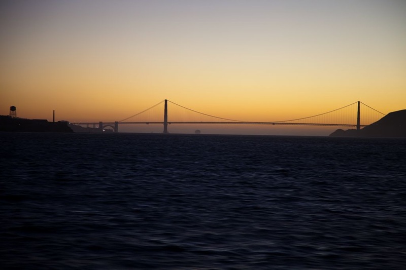
By the time we got back to the Ferry Terminal and had dinner the sun was just beginning to set. As we pulled away from the dock on the ferry ride back to our camp spot we could see the Golden Gate Bridge silhouetted against an amber sky and the lights of San Francisco just beginning to shine.
 Haight Ashbury  Grateful Dead's house, 710 Ashbury 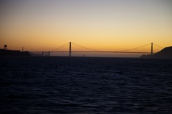 Golden Gate at dusk
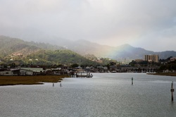 Larkspur Ferry Terminal area We took the Larkspur San Francisco ferry across the bay to San Francisco this morning. The ferry ride provided a scenic tour of the bay past San Quentin prison, Angel Island and Alcatraz plus views of the Bay Bridge and glimpses of the Golden Gate Bridge. As we approached the ferry dock we had an excellent panoramic view of downtown San Francisco.
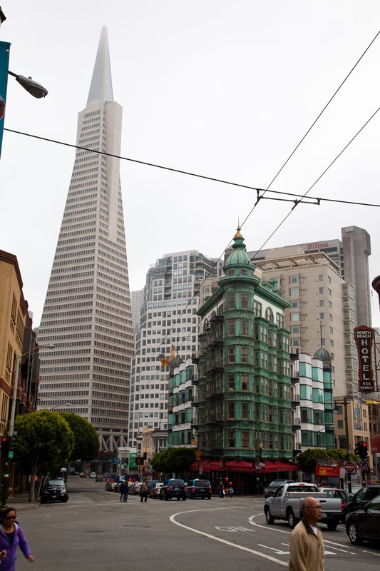
We did a long walking tour today. We headed from the Ferry Terminal along the Embarcadero to Fishermans Wharf. Then we headed up the hill to Chinatown. Today was the annual Chinese Moon Festival, so the area was jammed with Chinese families, dragon dancers, drum bands, booths of every kind and tourists. We had an excellent and very inexpensive meal there, then continued uphill to Nob Hill. We turned back down through the Financial District to our starting point. Every street provided a new and interesting sight. Bob took close 200 photos today. Some of these are included in the San Francisco album on the Photo Gallery page.
By the time we arrived back at the ferry terminal we were ready to sit on the boardwalk, sip a cup of tea and watch the sailboats in San Francisco Bay. 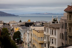 View toward the Golden Gate Bridge 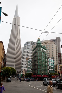 TransAmerica building from Chinatown  Late afternoon, looking back toward San Francisco
|


 RSS Feed